Mekong Eco Tour- HISTORY of MEKONG DELTA
HISTORY of MEKONG DELTA
The Mekong has its source in the icy wastes of the eastern Tibetan plateau. It flows south and east, through China, Myanmar, Thailand, Laos, Cambodia and Vietnam, emptying into the South China Sea through a wide delta south of Ho Chi Minh City (Saigon).
The Mekong is of immense significance as a natural boundary. Its unpredictable waters and shifting bed make fording or bridging almost impossible. From the bottom of the river jagged rocks as sharp as teeth extend to and above the surface of the river, making navigation dangerous.
The Mekong Delta was likely inhabited long since prehistory; the empire of Funan and later Chenla maintained a presence in the Mekong Delta for centuries.Archaeological discoveries at Oc Eo and other Funan sites show that the area was an important part of the Funan Kingdom, bustling with trading ports and canals as early as in the first century CE and extensive human settlement in the region may have gone back as far as the 4th century BCE.
The region was known as Khmer Krom (lower Khmer, or lower Cambodia) to the Khmer Empire, which likely maintained settlements there centuries before its rise in the 11th and 12th centuries. The kingdom of Champa, though mainly based along the coast of the South China Sea, is known to have expanded west into the Mekong Delta, seizing control of Prey Nokor (the precursor to modern-day Ho Chi Minh City) by the end of the 13th century.
Beginning in the 1620s, Khmer king Chey Chettha II (1618–1628) allowed the Vietnamese to settle in the area, and to set up a custom house at Prey Nokor, which they colloquially referred to as Sai Gon. The increasing waves of Vietnamese settlers which followed overwhelmed the Khmer kingdom-weakened as it was due to war with Thailand-and slowly Vietnamized the area. During the late 17th century, Mac Cuu, a Chinese anti-Qing general, began to expand Vietnamese and Chinese settlements deeper into Khmer lands, and in 1691, Prey Nokor was occupied by the Vietnamese.
Nguyen Huu Canh, a Vietnamese noble, was sent by the Nguyen Lords of Hue by sea in 1698 to establish Vietnamese administrative structures in the area. This act formally detached the Mekong Delta from Cambodia, placing the region firmly under Vietnamese administrative control. Cambodia was cut off from access to the South China Sea, and trade through the area was possible only with Vietnamese permission. During the Tay Son wars and the subsequent Nguyen Dynasty, Vietnam’s boundaries were pushed as far as the Cape of Ca Mau. In 1802, Nguyen Ánh crowned himself emperor Gia Long and unified all the territories comprising modern Vietnam, including the Mekong Delta.
Upon the conclusion of the Cochinchina Campaign in the 1860s, the area became Cochinchina, France’s first colony in Vietnam, and later, part of French Indochina. Beginning during the French colonial period, the French patrolled and fought on the waterways of the Mekong Delta region with their Divisions navales d’assaut (Dinassaut), a tactic which lasted throughout the First Indochina War, and was later employed by the US Navy Mobile Riverine Force. During the Vietnam War-also referred to as the Second Indochina War-the Delta region saw savage fighting between Viet Cong (NLF) guerrillas and units of the United States Navy’s swift boats and hovercrafts (PACVs).
Following independence from France, the Mekong Delta was part of the Republic of Vietnam and eventually the country of Vietnam. In the 1970s, the Khmer Rouge regime attacked Vietnam in an attempt to reconquer the Delta region. This campaign precipitated the Vietnamese invasion of Cambodia and subsequent downfall of the Khmer Rouge.


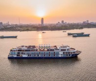
![Victoria Mekong Cruise – Ho Chi Minh City – Can Tho – Phnom Penh(5D/4N) [UPSTREAM 1]](https://mekongeco.com/images/thumbnail/268-445/1-2-2.jpg)
